


In a real safety incident, the alert is rarely the bottleneck. The bottleneck is the first question that follows: “Where are you?”
When location breaks at indoor/outdoor boundaries—or across multi-floor sites—response turns into searching. That’s exactly what POCSTARS Geo-Location is built to prevent: a multi-mode, high-precision positioning system designed for mission-critical facilities, with seamless indoor–outdoor coverage. Learn more about POCSTARS Geo-Location.
People Safety is not a “location” problem.
It’s an actionability problem: can teams move, escalate, and intervene with confidence, without losing minutes to uncertainty?
What makes People Safety location actionable (not just visible)
In People Safety workflows, three capabilities decide whether response starts immediately or stalls:
Continuous indoor–outdoor coverage — so the “dot” doesn’t disappear at boundaries. POCSTARS Geo-Location combines multiple positioning technologies (e.g., BLE, UWB, GNSS, 4G/5G, and more) in a modular system to balance accuracy and deployment practicality.
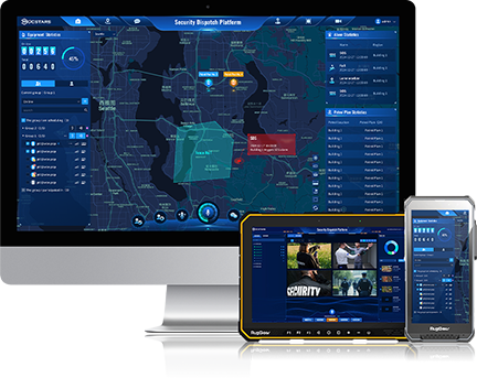
Multi-floor / mission-critical visualization — because “near Building A” is not enough. POCSTARS supports real-time tracking on a digital map and 3D modeling for accurate three-dimensional positioning in complex sites.
Decision support, not raw coordinates — responders need “who / where / what changed”. Modules like Trajectory Query, Location Fence, and an Alarm Center help teams turn movement and events into consistent operational actions.
Three People Safety moments where location continuity decides outcomes
1) SOS / Duress
An SOS without precise location turns into a search mission.
An SOS is a strong signal, but it isn’t automatically actionable. In multi-floor sites and mixed environments, the first minutes are often wasted on “Where are you?” loops, partial indoor visibility, and conflicting updates across teams.
To make SOS actionable, the workflow must produce a single, time-stamped event that responders can trust: best-available position plus operational context (building / floor / zone where available), so the first response is movement, not triangulation.
How POCSTARS Geo-Location helps in this moment:
Geo-Location Tracking to view real-time positions of personnel/vehicles on a digital map, filter by name, and highlight the right individual fast.
3D Modeling (UWB-based) for multi-floor and complex-site positioning where 2D views fail.
Alarm Center + Alarm Handling to centralize events so teams don’t coordinate across scattered channels.
Edge computing options to keep processing efficient and reduce dependency on perfect connectivity in the middle of an incident.
Operational metric to watch: reduced “search time after SOS” and faster first-responder arrival.
2) Overdue check-in / Missing worker
The most dangerous moment is when a worker goes silent.
Silence creates a decision problem: escalate too slowly and risk rises; escalate too quickly and resources get burned. Most teams default to wide-area sweeps because they can’t reduce the unknowns fast enough.
What good looks like is not “more alerts”. It’s last-known clarity that teams can act on consistently: where the person was, and how the situation evolved, so localization happens before escalation becomes chaotic.
How POCSTARS Geo-Location helps in this moment:
Trajectory Query to narrow the search scope using movement traces instead of guessing across the whole site.
Hierarchical Location and Map Management to translate coordinates into operational language (site / building / floor / area).
Alarm Center to manage escalations with a single operational view, not fragmented updates.
Electronic roll-call / identity-based visibility (where configured) to support faster accountability and decision-making.
Operational metric to watch: shorter “unknown window” (silence → actionable location) and fewer unnecessary escalations.
3) Restricted zone breach
Most incidents start with one wrong step into the wrong zone.
Many safety failures begin before the alarm—at boundaries. Contractors, shift changes, and unfamiliar routes increase drift. If detection happens late, response becomes reactive by default.
The goal is early, proportional intervention: detect the boundary breach with enough context to act appropriately, before the situation escalates.
How POCSTARS Geo-Location helps in this moment:
Location Fence to define boundaries and trigger alerts when personnel/vehicles enter restricted areas.
Alarm Center + Alarm Statistics to manage and review boundary events consistently (not as one-off incidents).
Crowd Density Alert (heatmap + threshold parameters) to surface risky crowding patterns before they become safety events.
Optional video management capabilities to help validate certain safety violations and abnormal behaviors when combined with site policies and workflows.
Operational metric to watch: earlier intervention and reduced time-to-detect for boundary breaches.
Want to see how Geo-Location works in a real deployment?
Read the Geo-Location Case StudyNew to Geo-Location? View the solution overview.
Conclusion
People Safety incidents don’t fail because teams don’t care. They fail because the first minutes are spent reducing uncertainty. When location remains continuous across complex sites, response becomes measurable—and improvable.
POCSTARS Geo-Location keeps people visible and response-ready — indoors and outdoors.